if you cannot find answer to your question our FAQ, you can alwas contact us. web will answer you shortly!


Interferometric Synthetic Aperture Radar (InSAR) is a powerful remote sensing technique used for monitoring of landslides. By comparing radar images captured at different times, InSAR can detect ground deformation with an accuracy upto 2-3 mm. InSAR can identify slow moving landslides before they become catastrophic, enabling early warning systems and informed decision making to mitigate risks and protect communities.
P&G provides InSAR monitoring services through its sister concern INERSIA based out of Barcelona, Spain.
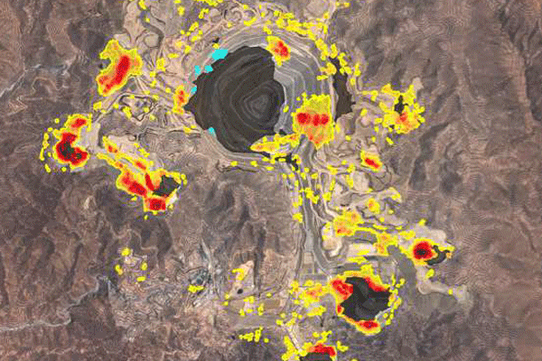
In open pit mining, InSAR plays a crucial role in monitoring ground stability and ensuring operational safety. By capturing high-resolution radar images over time, InSAR detects even slight surface deformations caused by mining activities, such as slope instability or subsidence.
InSAR is used to monitor tailing dams. These structures are critical but can be prone to instability, leading to catastrophic failures. It allows continuous, remote monitoring of tailing dams by detecting minute ground movements over time. This capability is essential for identifying signs of potential dam failure, such as deformation or subsidence, before they become critical.
Our post-construction services gives you peace of mind knowing that we are still here for you even after.